
Spring is here, which means the warm weather is on its way. You may not realize this, but I consider myself an expert in understanding weather patterns. It’s my dream to become a weather forecaster. Here’s some basic information you should know to understand weather.
Basic Weather Patterns
The most basic rule of weather is this: What happened yesterday is likely to happen today. Though it sounds banal, this is actually a useful rule of thumb for weather prediction.
The default behavior of weather is to continue in a daily pattern. The pattern changes only when some new influence occurs to break it. The key to predicting weather is learning the signals that a change is coming. If no signals are present, expect a high likelihood that the weather will remain the same as the day before.
Atmospheric Pressure
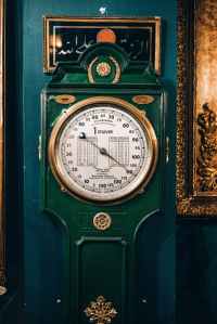
One of the most reliable metrics for noticing oncoming weather changes is atmospheric pressure. This is also called barometric pressure, or the force exerted by the weight of air above you. There is a standard atmospheric pressure for any location based on altitude, but actual pressure varies greatly with weather. High pressure means that air is weighing down more than normal, and this is a sign of stability in the atmosphere. Low pressure means that air is moving upward and is generally a sign of shifting weather.
- High/rising pressure: Air is staying put at the land surface. Indicates stable weather.
- Low/falling pressure: Air is moving upward from the land surface into the atmosphere. Indicates changing weather.
Clouds
Clouds are obviously an indispensable weather indicator, but they can be difficult to read because of their complexity. With experienced observation, clouds can tell you not only whether or not it will rain but what type of rain to expect. You must pay attention to the type of clouds, their relative altitude and the difference in cloud layers. Meteorologists assign cloud forms to an extensive classification system where shape, size and position in the atmosphere define their characteristics. Below are the three most basic types of clouds and what they mean to forecasting in the field. You can refine your predictions by researching clouds in greater depth.
Cirrus Clouds
Cirrus: Thin, wispy or streaky white clouds at high altitude. Cirrus clouds against a blue sky mean that air and moisture are moving around high in the atmosphere but don’t always mean changes at ground level. They can occur during either high or low pressure systems. When cirrus clouds are more continuous and cover most of the sky in a thin veil or make a halo of light visible around the sun, they are a stronger signal of changes on the way. Don’t try to read too much into cirrus clouds, but when you see them, pay close attention to whatever happens in the next 24 hours.

Stratus Clouds
These are low- to mid-altitude clouds that are highly variable in form but tend to make layers. They may be wispy or puffy, white or gray. They may be scattered or continuous. They do not necessarily mean rain. If they are scattered and mostly white, or if they are continuous but you can see the sun through them, rain is probably not imminent. Also, many stratus clouds of different forms that you can see in different layers are much less likely to produce rain than those that are joined into a continuous layer at even altitude. When stratus clouds begin to aggregate in such a way, or when the scattered ones become big and dark, watch out for rain and increased winds. Stratus clouds that bring rain are typically brought by moist warm fronts and low pressure.
Cumulus Clouds
These clouds are standard white, puffy clouds that form at low altitude. On their own they do not necessarily mean rain. Watch out if you notice them joining and darkening or if you see them building to become very tall and dark. Low pressure conditions can cause cumulus clouds to build into stormy cumulonimbus clouds, commonly called thunderheads. These types of clouds are typical of summer showers in many parts of the continent; they can pop up overhead, but large banks of cumulus clouds can also move in with cold fronts.
I hope you have enjoyed learning about the weather!
About Zoe Hernandez: Zoe lives in Meriden, Connecticut. A Quantum® brand ambassador, Zoe attends Abilities Expos and speaks with people about her disability. She is currently enrolled in college and hopes to work in a community one day with people who are just like her. Click here to learn more about Zoe.